


On the frontlines of emergency safety work, time means life, and data forms the foundation for decisions. When disasters strike: how far has the landslide moved? What is the remaining safe distance between the fire and residential areas? Every second tests the judgment of front‑line commanders.
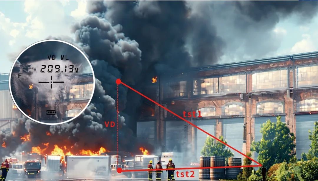
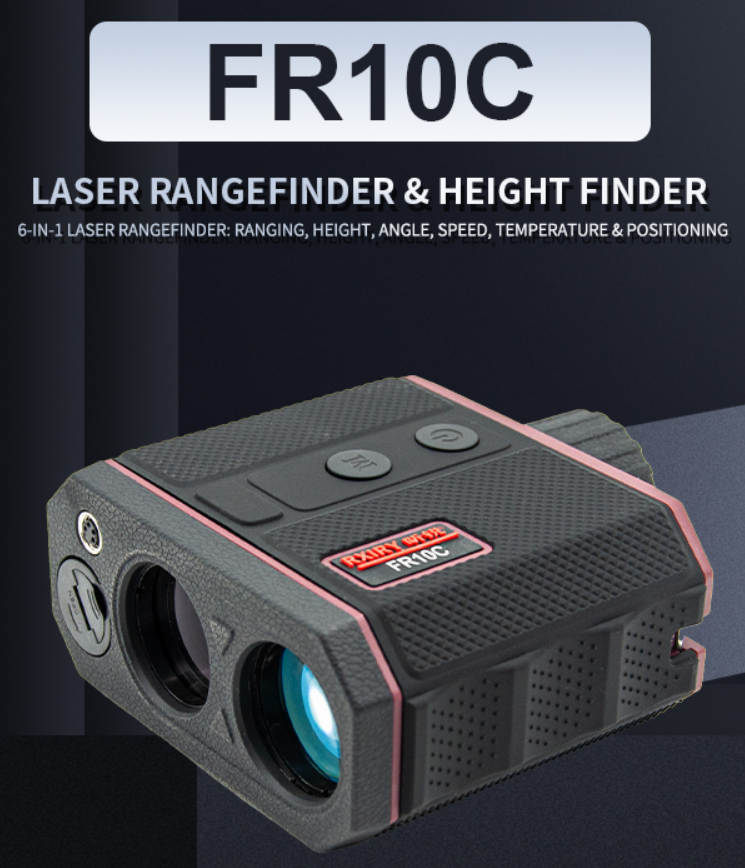
Now, the newly‑upgraded Rxiry FR10C Laser Rangefinder delivers ultra‑high accuracy of ±4 cm, ten‑kilometer‑class long‑range measurement and instant data output, bringing a revolution of “precision and efficiency” to the emergency safety industry.
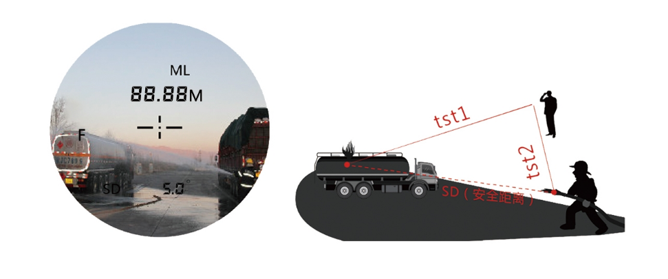
Emergency System Search and Rescue:
Measure the hazard source and rescue position respectively, quickly obtain the safety distance SD between the hazard source and rescuers, and provide scientific support for on‑site warning and personnel risk avoidance.
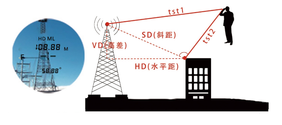
Public‑Safety System Base Station Monitoring:
Measure any point on the base station and the building to get the straight‑line 3D values from the base station to the building, ensuring facility layout complies with safety regulations.
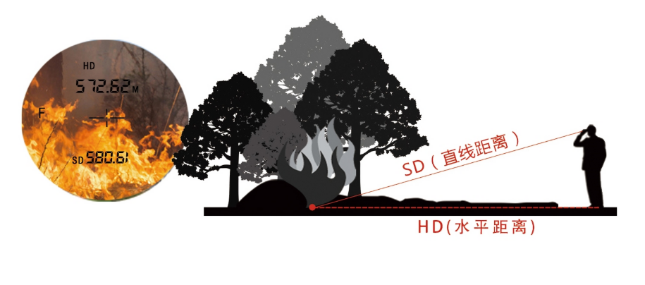
Forest Fire Prevention & Rescue:
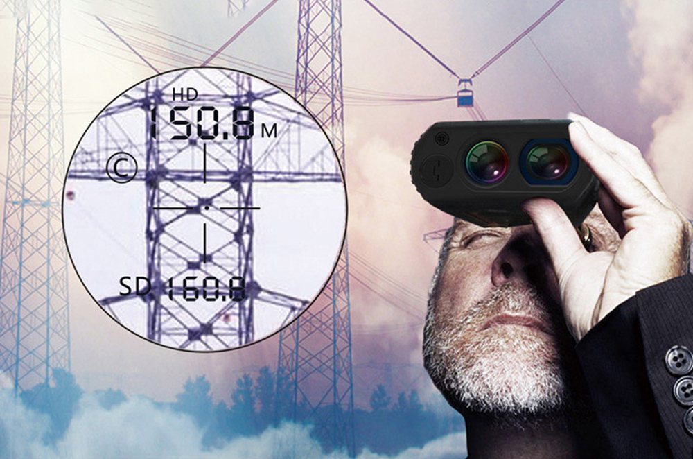
Aim at the fire source for measurement, and instantly get the horizontal distance HD and straight‑line distance SD to the fire point. Provide precise coordinates for fire‑extinguishing bomb launching and fire‑fighting route planning.
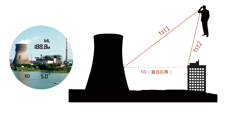
Dual‑Target Measurement for Public Safety:
Measure the target and safety‑source points respectively to obtain the straight‑line distance SD between them. (Horizontal distance HD and vertical difference VD can also be displayed.) Quickly assess the risk scope.
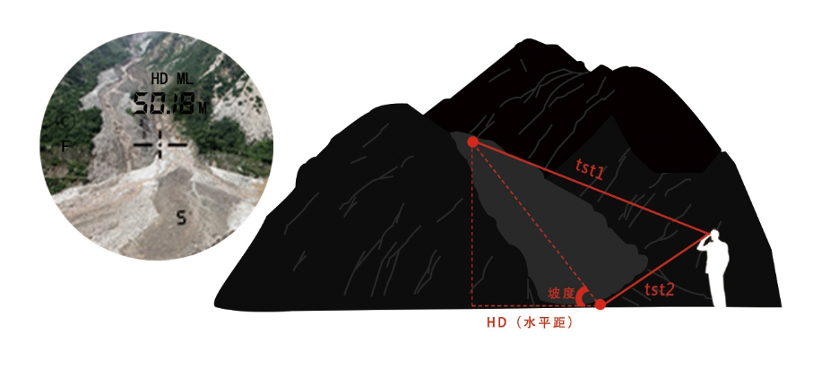
Debris‑Flow Emergency Assessment: Measure the horizontal distance and slope value of debris flow within the same vertical plane to deliver real‑time terrain information for rescue‑route planning and risk assessment.
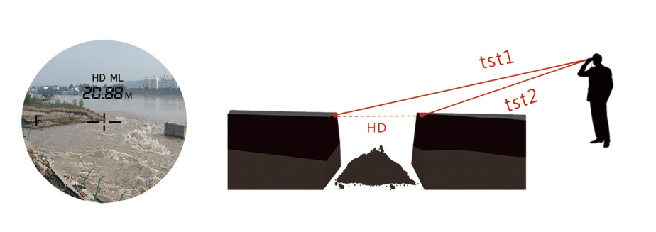
Dam Hazard Monitoring:
Measure two target points on the dam respectively to obtain the horizontal distance between them, assisting in judging dam displacement and crack changes.
High‑Rise Building Fire Rescue:
Measure the fire point and ground respectively to quickly get the vertical difference VD from the fire point to the ground, providing critical reference for ladder truck deployment and high‑altitude fire‑fighting.
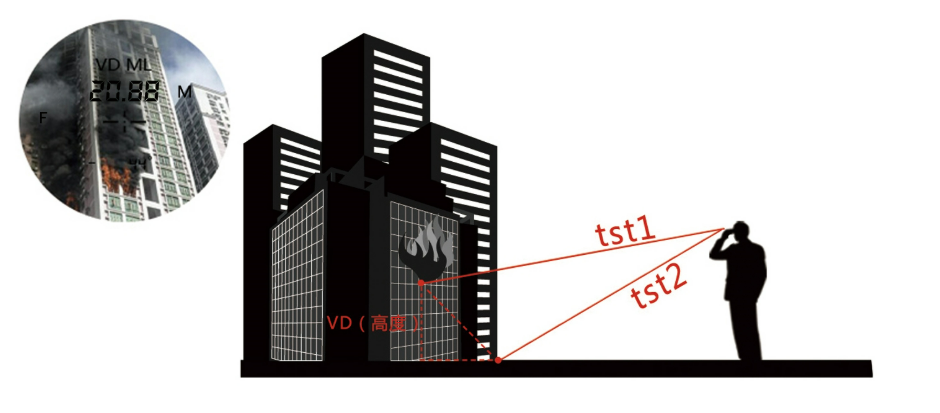
One FR10C covers multiple core scenarios of emergency safety. No need to step into dangerous zones, you can remotely acquire key spatial data.
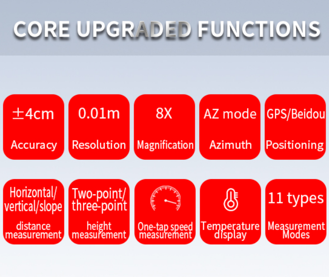
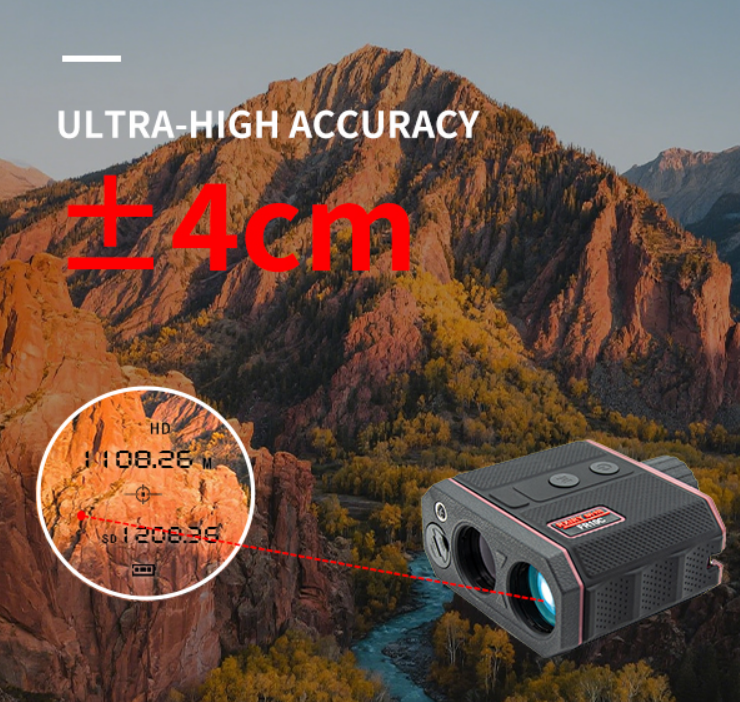
In the field of emergency safety, data accuracy directly determines decision‑making quality. The RXIRY FR10C boosts measurement accuracy to ±4 cm with a resolution of up to 0.01 m. Whether measuring landslide displacement or assessing safe gaps between buildings and hazard sources, every set of measured data is solid and reliable.
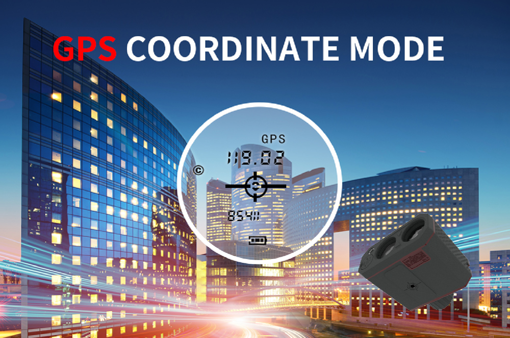
The FR10C offers optional dual‑mode GPS and BeiDou. Users can flexibly select according to operational requirements. The rangefinder can obtain coordinates of its current location and directly collect position coordinates of target points. Location information is fully accessible no matter where you are.
Emergency sites feature complex‑colored targets — dark rock walls, black oil tanks, white building exteriors, and more.
Ordinary rangefinders often suffer reduced accuracy due to color differences. Equipped with black‑and‑white compensation algorithm, the FR10C effectively offsets reflection deviations caused by varying colors. It delivers stable and accurate data regardless of light or dark target surfaces.
Meanwhile, temperature fluctuations can cause component drift inside conventional rangefinders.
The FR10C has a built‑in temperature compensation mechanism, which real‑time corrects measurement deviations caused by temperature changes within its operating‑temperature range. Measurement results remain stable and reliable in extreme cold or scorching heat.
At emergency sites, every extra second means additional risk.
The FR10C supports a maximum measuring distance of 10,000 meters. Powered by a high‑speed laser ranging engine, it instantly returns distance and azimuth data once you aim at the target and press the button, with barely perceptible latency. Combined with upgraded 8‑times optical magnification and fully‑coated optical lens, targets thousands of meters away are clearly visible.
The FR10C features 11 practical functions: horizontal distance measurement, vertical distance measurement, slant range, two‑point height measurement, three‑point height measurement, angle measurement, speed measurement, temperature measurement, azimuth angle and more. One unit meets all demands ranging from emergency rescue and forest fire prevention to landslide assessment and building height measurement.
The FR10C supports Bluetooth connection to the professional Rxiry Measurement APP. Measurement data can be wirelessly transmitted to mobile phones or tablets with one click. The APP is fully‑featured, covering area measurement, offset measurement, latitude‑longitude collection, camera viewfinder, data export, audio recording and other functions. Operation is straightforward. After downloading the Rxiry Measurement APP, simply follow the on‑screen prompts step by step for quick and easy setup.
The Rxiry FR10C Laser Rangefinder, with robust strengths including ±4 cm accuracy, 10,000‑meter measuring range and instant response, has become an indispensable “data‑driven tool” for front‑line emergency safety operations.
For more product details or procurement inquiries, please feel free to contact us.

 Tel:+86-147-6265-1990
 Mail:amy@rxiry.com; rachel@rxiry.com
 Add:6-3, Huai 'an Zhiche City Industrial Park, No. 642, Huaihe Road, Huaiyin District, Huai 'an City, Jiangsu Province, China
Copyright © 2022 RXIRY ( JIANGSU ) OPTOELECTRONIC CO., LTD All Rights Reserved.
XMLMAPTECHNICAL SUPPORTXIHE NETWORK




 POSITION: